Your council has an active transport strategy. You may even have secured funding — from the $100 million National Active Transport Fund, or from the NSW Government’s $60 million Get NSW Active grants program. You know cycling infrastructure is important for liveability, health outcomes, and climate targets.
But do you have the data to make the right decisions about where to build, what to build, and how to prove it’s working?
If not, you’re not alone. Most Australian councils face the same challenge: ambitious active transport goals, growing funding pools, and a persistent gap in the data needed to translate strategy into effective infrastructure.
This guide walks through five practical steps to close that gap.
Step 1: Audit Your Current Data Sources
Before investing in new data collection, take stock of what you already have — and where the gaps are.
Questions to Ask
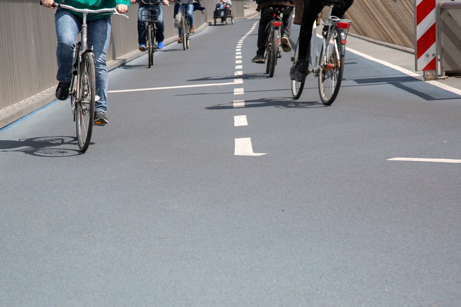
- Fixed counters: Where are they located? How many do you have? When were they last calibrated? Do they cover your entire cycling network, or just a few high-traffic points?
- Manual surveys: When was your last manual count? How frequently do you conduct them? Do they capture weekday and weekend patterns? Peak and off-peak?
- Demographic data: Do you know who is riding in your LGA — not just how many? Can you break down ridership by age, gender, or trip purpose?
- Route data: Can you measure route usage end-to-end, or only at the specific points where counters are installed?
- Infrastructure condition: Do you have a systematic way to identify and prioritise infrastructure defects, surface issues, or dangerous intersections?
The Typical Finding
Most councils discover that their data is point-based (counting at specific locations), periodic (snapshots rather than continuous), and demographic-blind (raw numbers with no understanding of who is riding).
This means infrastructure decisions are based on incomplete information — and the resulting projects are vulnerable to political challenge because there’s no comprehensive evidence base to defend them.

Step 2: Identify What You Actually Need to Know
Different data serves different planning needs. Be specific about the questions you’re trying to answer.
Where Are People Riding?
Route data — complete origin-to-destination journeys — reveals the desire lines that should inform your infrastructure priorities. It shows where riders are forced onto roads without cycling infrastructure, where network gaps force detours, and where new connections would have the greatest impact.
This is fundamentally different from point data. A counter tells you 500 cyclists per day pass a location. Route data tells you where those 500 cyclists came from, where they’re going, and which 200 of them would use a new path if you built one on the parallel street.
Who Is Riding?
Demographic data transforms the conversation about cycling infrastructure. A City of Sydney study found that safety is the number one barrier for women cyclists — with 64% saying separated cycleways were the most important factor in their route choice, and 62% prioritising bike lanes.
The same study revealed a striking perception gap: only 21% of women identified themselves as cyclists, despite riding regularly. And 56% said the typical image of a cyclist was “not me.”
If you don’t know who is riding in your area — and who isn’t riding but would if conditions improved — you’re planning for the riders you can see, not the ridership you could unlock.
When Are They Riding?
Temporal patterns inform everything from lighting priorities to signal timing to maintenance schedules. Commute peaks, school-run patterns, weekend recreational use, and seasonal trends all tell different stories about how your infrastructure is being used.
Where Do They Want to Ride But Can’t?
Gap analysis is where data becomes most powerful for planning. By combining route data with network maps, you can identify the missing connections — the 200-metre gaps, the unsafe intersections, the sections where riders are forced to dismount or share space with heavy traffic — that prevent your cycling network from functioning as a coherent whole.
What Are the Problems?
Infrastructure quality data from riders themselves — surface defects, drainage issues, vegetation encroachment, faded markings, dangerous intersections — provides a real-time feedback loop that complements your scheduled maintenance inspections.

Step 3: Complement Fixed Infrastructure With Crowdsourced Data
The most effective approach isn’t choosing between traditional methods and new technology — it’s combining them.
What Fixed Counters Do Well
Fixed counters provide reliable baseline measurements at key locations. They’re always on, they don’t depend on user participation, and they produce consistent longitudinal data. Keep your counters — they’re valuable.
What Crowdsourced Platforms Add
Smartphone-based crowdsourced platforms fill the gaps that fixed infrastructure can’t cover:
- Network-wide route coverage — data from every street riders use, not just where counters are installed
- Demographic insights — age, gender, and experience level of riders
- Real-time infrastructure feedback — rider-reported surface issues, hazards, and safety concerns
- Before/after measurement — track how ridership patterns change when new infrastructure is built
- AI-powered detection — identification of road surface issues, obstacles, and problematic intersections from ride data
The Combination
Used together, fixed counters and crowdsourced data create a comprehensive picture:
| Data Need | Fixed Counters | Crowdsourced Platforms |
|---|---|---|
| Volume at key points | Strong | Moderate |
| Network-wide routes | Not possible | Strong |
| Demographics | Not possible | Strong |
| Real-time feedback | Limited | Strong |
| Before/after analysis | Single point | Network-wide |
| Cost per data point | High (hardware) | Low (software) |
Step 4: Build Data Into Your Decision-Making Process
Data is only valuable if it informs decisions. This means embedding it into your existing planning and reporting processes.
Infrastructure Planning Meetings
Bring cycling data dashboards to the table. When discussing a proposed new path or cycleway, show the existing route data for that corridor: how many people are already riding there, what routes they’re taking, and what the projected impact of new infrastructure would be based on demand patterns.
Before/After Metrics
For every new piece of cycling infrastructure, establish baseline measurements before construction begins and track changes after completion. Key metrics:
- Ridership volume — total trips on the new infrastructure and surrounding network
- Demographic shift — are new rider groups appearing (more women, families, older riders)?
- Route changes — are riders shifting from less safe parallel routes to the new infrastructure?
- Safety indicators — reduction in rider-reported incidents or near-misses
This data becomes your evidence base for future investment. If a $200,000 path section increased ridership by 40% and attracted a measurably more diverse rider demographic, that’s a compelling case for the next project.
Political Resilience
Build transparent reporting into your active transport strategy. Publish usage data regularly — not just annual reports, but quarterly or monthly updates that show trends. When constituents and elected officials can see that cycling infrastructure is being used and that usage is growing, the political case for continued investment is much harder to attack.
Funding Applications
Data-driven proposals are more competitive. Both the National Active Transport Fund (up to $5 million per project) and the Get NSW Active program (up to $5 million per project) require councils to demonstrate need and expected outcomes. Comprehensive cycling data strengthens every section of a funding application — from problem identification to projected impact.

Step 5: Engage Your Community as Data Partners
The most sustainable approach to cycling data collection isn’t top-down — it’s collaborative. Riders who contribute data become invested in the outcomes, and the data they generate is richer than anything a council could collect alone.
Encourage Group Rides
Group rides simultaneously build ridership and generate data. When a community cycling group rides a route together, the platform captures multiple data points for the same journey — confirming route preferences, revealing shared safety concerns, and demonstrating community demand.
The City of Sydney’s “On the Go” report specifically recommended “travel companion programs, such as walking or riding mentors and women’s walking buses to help build confidence, feelings of safety and connections.” Group riding programs deliver exactly this — and the data that comes with it.
Partner With Local Cycling Groups
Bicycle User Groups (BUGs), cycling advocacy organisations, and community sporting clubs are natural data partners. They have established rider communities, they understand local cycling conditions, and they’re motivated to contribute to better infrastructure outcomes.
Run Pilot Programs With Measurable Outcomes
A 6-month pilot program with a crowdsourced data platform can provide more actionable cycling data than years of manual surveys. Define clear objectives upfront:
- Map cycling routes across the LGA
- Identify the top 10 network gaps based on rider desire lines
- Measure demographic composition of riders
- Collect infrastructure quality feedback
- Establish baseline measurements for planned infrastructure projects
Pop-Up Infrastructure Testing
Use data to identify locations for temporary or pop-up cycling infrastructure — then measure the response. If a temporary separated lane on a busy road shows a 50% ridership increase in three months, that’s evidence for permanent investment. If it doesn’t, you’ve learned something valuable at a fraction of the cost.

Funding Available Now
The funding environment for active transport in Australia has never been stronger. Across federal and state programs, hundreds of millions of dollars are available for cycling and walking infrastructure. But data-driven proposals are more competitive — and projects backed by evidence are more likely to survive the full funding and delivery cycle.
Federal Programs
National Active Transport Fund
- $100 million over four years (2024-25 to 2028-29)
- Up to $5 million per project
- Construction of new or upgrade of existing bicycle and walking paths
- More than $96 million already allocated across all states and territories
Road Safety Program (often overlooked for active transport)
- $968 million over three years (2023-24 to 2025-26), 50:50 federal-state co-funded
- Explicitly includes pedestrian and cycleway improvements as eligible treatments
- Each state receives a significant allocation (e.g., NSW received $518 million across three years)
Black Spot Program
- Progressively increasing to $150 million per year nationally
- Funds intersection upgrades, pedestrian crossings, and cycleway improvements at crash-prone locations
- Councils nominate sites through their state road agency
State and Territory Programs
| State | Program | Annual Funding | Key Details |
|---|---|---|---|
| NSW | Get NSW Active | $60M per round | $30K–$5M grants; all NSW councils eligible |
| QLD | Active Transport LG Grants | $15M per round | Up to 50% of project cost; all QLD councils |
| WA | WA Bicycle Network Grants | $8M/year | $4M metro + $4M regional; part of $310M broader commitment |
| VIC | TAC Local Government Grants | Up to $100K/project | 1:1 council co-contribution; pedestrian/cyclist safety focus |
| SA | State Bicycle Fund | $2M/year | 50:50 co-contribution with councils; metro and regional |
| TAS | Better Active Transport Grants | ~$9.2M total | All Tasmanian municipal councils eligible |
| ACT | Active Travel Plan | $94M+ total | Directly delivered by ACT Government (no grants) |
Making Your Application Stand Out
Funding bodies receive far more applications than they can fund. In the 2024-25 Get NSW Active round, 345 applications sought $287.6 million — for a pool of $60 million. The projects that get funded are the ones that best demonstrate need, feasibility, and projected impact.
Comprehensive cycling data gives you an edge at every stage: identifying the right project, quantifying the need, projecting the outcomes, and demonstrating that you have the systems in place to measure success.
Getting Started
You don’t need to overhaul your entire data collection approach overnight. Start with these practical steps:
- Audit your existing data sources and identify the biggest gaps
- Define the specific questions you need data to answer for your next infrastructure project
- Pilot a crowdsourced data platform alongside your existing tools for 6 months
- Integrate the data into your planning meetings, funding applications, and public reporting
- Engage your community as active data partners through group rides and local cycling organisations
The cities that invest in better cycling data today will build better infrastructure tomorrow — and they’ll have the evidence to prove it.
Start a Pilot Program
6-month trial with full analytics dashboard for your council.
Contact Party OnbiciSee the Data Platform
Explore what crowdsourced cycling analytics looks like in practice.
Request a DemoReady to Improve Your Active Transport Data?
Party Onbici works with councils and transport agencies across Australia to provide crowdsourced cycling data, analytics dashboards, and infrastructure insights. Whether you're planning your first cycleway or optimising an existing network, better data leads to better outcomes — for riders, for ratepayers, and for your city's liveability.
Contact us to discuss a pilot program tailored to your council's needs.
Sources:
- National Active Transport Fund — Minister for Infrastructure, Transport, Regional Development and Local Government
- Active Transport Fund Resources — Department of Infrastructure
- Road Safety Program — National Road Safety Strategy
- Black Spots Program — Infrastructure Investment Program
- Get NSW Active — Transport for NSW
- Get NSW Active 2024-25 — NSW Government
- Active Transport Local Government Grants — Queensland TMR
- WA Bicycle Network Grants Program — Transport WA
- TAC Local Government Grant Program — Victoria
- Cycling Grants — SA.GOV.AU
- Active Transport Programs — Transport Tasmania
- Active Travel Plan — ACT Government
- On the Go: How women travel around our city — City of Sydney / C40 Cities
- Federal active transport funds start to flow — Bicycle Network
- Party Onbici: Cycling Social, Safer, Smarter — Smart Cities Council