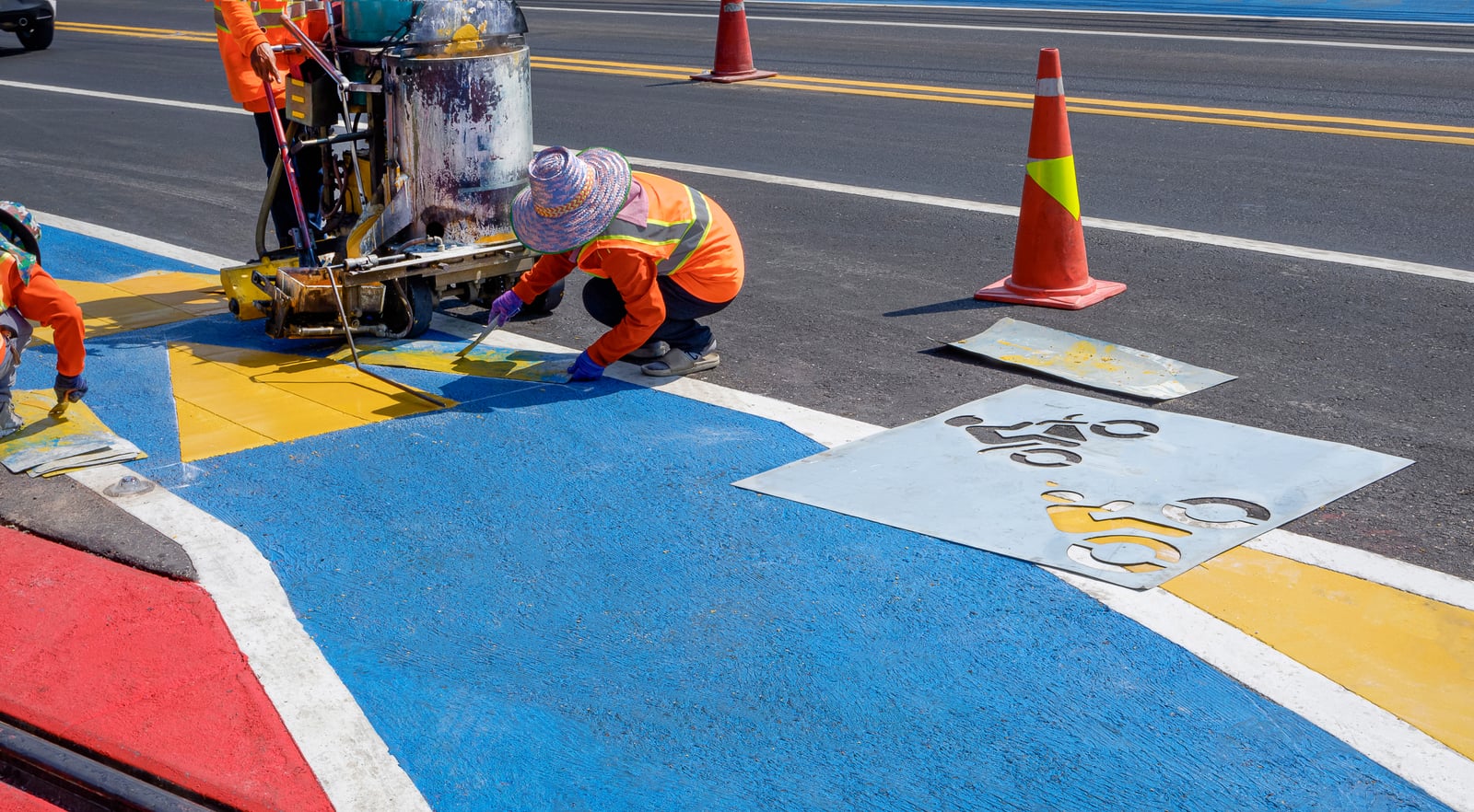
Australian governments are pouring unprecedented funding into active transport. The Federal Government has committed $100 million to a National Active Transport Fund. The $968 million Road Safety Program includes cycling and pedestrian improvements. NSW is investing $60 million per round through Get NSW Active. Queensland has a $15 million Active Transport grants program. Western Australia has committed $310 million for walking and riding infrastructure. Every state and territory has funding on the table — and cities across the country are building bike lanes, shared paths, and cycling infrastructure at an unprecedented rate.
But here’s the uncomfortable question: do cities actually know where to build?
The answer, for most local councils, is no. And the consequences of getting it wrong are measured not just in wasted dollars, but in infrastructure that gets ripped out, political capital that evaporates, and communities that lose faith in cycling investment altogether.
The Measurement Gap
Most cities rely on a combination of fixed-position counters, manual surveys, and proprietary hardware to measure cycling activity. Each of these has significant limitations.
Fixed-Position Counters
Electromagnetic loops or infrared sensors embedded at specific locations can tell you how many cyclists pass a single point. But they can’t tell you:
- Where those cyclists came from or where they’re going
- What route they took to get there
- Whether they’re commuters, recreational riders, or families
- What the cycling demand looks like on streets without counters
A counter on a popular bridge tells you that bridge is popular. It tells you nothing about the thousands of potential trips that aren’t happening because the streets leading to that bridge feel unsafe.
Manual Surveys
Counting cyclists by hand at intersections during peak hours remains a common practice. It’s labour-intensive, infrequent, and provides only a snapshot. A single survey might miss seasonal patterns, weather effects, or the gradual growth that indicates an infrastructure investment is working.
Proprietary Hardware
GPS devices designed specifically for cycling data collection require riders to own and use a separate device. This limits participation to a self-selecting group and creates a dataset skewed toward enthusiasts rather than the everyday riders that infrastructure investment is meant to attract.

The Consequences of Poor Data
When cities build cycling infrastructure based on incomplete data, the results can be damaging — not just for the specific project, but for the broader case for cycling investment.
Infrastructure Built in the Wrong Places
In 2022, Canada Bay Council in Sydney completed a section of separated cycleway on Heath Street, Five Dock — part of a $7 million east-west regional cycleway funded by the NSW Government. Within five months, the council voted to remove it following community complaints about reduced sight distances for motorists.
The cycleway section cost $17,000 to construct. The NSW Department of Planning made clear that removal costs would be at the council’s expense. Bicycle NSW called the decision a “knee-jerk reaction” that set “a terrible precedent.”
The real cost wasn’t just financial. It was a loss of confidence — in the council’s planning process, in cycling infrastructure as a concept, and in the ability of cities to make evidence-based transport decisions.
Vulnerability to Political Pressure
Without hard data demonstrating usage, growth trends, and community benefit, cycling infrastructure becomes an easy target for political opposition. Across Australia, council elections have seen candidates campaign on platforms of removing bike lanes — framing cycling infrastructure as a waste of money rather than an investment in liveability.
When the only evidence is anecdotal — “I never see anyone using it” — opponents have the upper hand. Data changes that equation entirely.
Missed Opportunities
Perhaps the most significant cost of poor data is what doesn’t get built. Without network-wide route data, cities miss the connectors, the last-kilometre links, and the low-cost improvements that could unlock significant ridership growth. A missing 200-metre connection between two existing paths might be the difference between a usable cycling network and a fragmented collection of isolated segments.

What Cities Actually Need to Know
Effective cycling infrastructure planning requires answers to questions that fixed counters and manual surveys simply can’t provide.
Route Data, Not Just Point Data
Cities need to understand where people are actually riding — complete origin-to-destination routes, not just counts at specific locations. This reveals the desire lines that should inform infrastructure priorities and the gaps in the network where riders are forced onto unsafe roads.
Demographic Data
A City of Sydney study found that only 21% of women surveyed identified as cyclists, despite many of them riding regularly. The same study found that 47% of respondents perceived riders as “fit, healthy and active” — and 10% specifically described cyclists as male, with some referencing “middle-aged men in lycra.”
This perception gap matters. If cities are building infrastructure based on data from a narrow demographic, they’re designing for the riders they already have rather than the riders they could attract. Understanding who rides — by age, gender, and experience level — is essential for inclusive infrastructure planning.
Temporal Patterns
When are people riding? Commute peaks look different from school-run patterns, which look different from weekend recreational use. Seasonal trends reveal whether infrastructure is serving year-round transport needs or just fair-weather recreation. Time-of-day data can inform lighting priorities and signal timing.
Safety and Infrastructure Quality
Rider-reported data on road surface issues, dangerous intersections, near-misses, and infrastructure defects provides a real-time feedback loop that complements formal safety audits. When hundreds of riders independently flag the same intersection as problematic, that’s evidence a council can act on immediately.
The Opportunity: Crowdsourced Data
The solution to the measurement gap isn’t more expensive hardware — it’s the devices riders already carry in their pockets.
Crowdsourced cycling data from smartphone-based platforms fills every gap that traditional methods leave open:
- Network-wide route coverage — not limited to where counters are installed
- Demographic breakdowns — age, gender, and experience level, not just raw counts
- Real-time and historical trends — continuous data collection, not periodic snapshots
- Infrastructure feedback — rider-reported issues, surface quality, and safety concerns
- Before/after analysis — measure the actual impact of new infrastructure on ridership patterns
This isn’t theoretical. Transport for NSW endorsed Party Onbici as a graduate of their Active Transport Bike Riding Innovation Challenge. The platform was selected as a semi-finalist in the Toyota Mobility Foundation’s $3 million Venice Sustainable Cities Challenge, and participated in the NSW Government’s Smart Cities Innovation Challenge focused on safer public spaces for women and girls.
The data already shows results. The City of Sydney’s “On the Go” study recommended that cities “support the establishment of local women’s walking and riding groups and programs, particularly in areas with existing low riding and walking participation and where women are more likely to feel unsafe.” Group riding platforms generate exactly this kind of participation — and the data that comes with it.
Building the Case for Investment
The cities that will get the most value from the current wave of active transport funding aren’t the ones spending the most. They’re the ones spending most wisely — using data to target investment, measure outcomes, and build the evidence base that protects infrastructure from political backlash.
Better cycling data doesn’t just improve infrastructure planning. It transforms the entire conversation around cycling investment from opinion-based to evidence-based. And in a political environment where every dollar of public spending faces scrutiny, evidence is the most powerful tool a city planner can have.
For City Officials
If your council is planning active transport infrastructure, you don't have to rely on incomplete data. Crowdsourced platforms can complement your existing measurement tools with network-wide route data, demographic insights, and real-time infrastructure feedback — at a fraction of the cost of traditional methods.
Better data means better infrastructure. Better infrastructure means more riders. More riders means healthier, more liveable cities.
Sources:
- National Active Transport Fund — Minister for Infrastructure, Transport, Regional Development and Local Government
- Road Safety Program — National Road Safety Strategy
- Get NSW Active — Transport for NSW
- Active Transport Local Government Grants — Queensland Department of Transport and Main Roads
- WA Bicycle Network Grants Program — Transport WA
- ‘Knee-jerk reaction’: Sydney cycle path to be ripped up months after opening — Sydney Morning Herald
- Hands Off Heath Street Cycleway — Bicycle NSW
- On the Go: How women travel around our city — City of Sydney / C40 Cities
- Party Onbici: Cycling Social, Safer, Smarter — Smart Cities Council
- Venice Sustainable Cities Challenge Semi-Finalists — Toyota Mobility Foundation